Showing posts with label state parks. Show all posts

Thursday, 19 May 2011

State Parks


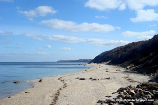
Sherwood Island State Park; April 2010


Unfortunately, this is the time of year when restrictions and fees go into effect at local beaches and parks on Long Island Sound. If you are not a town resident, chances are you will be denied entry to the park, or else, be  required to pay a much heftier admission fee.


The argument goes something like this:
Local taxes pay for the upkeep and operating costs, therefore, the beach should be restricted to town residents only.


Makes sense -- until you realize what would happen if every town behaved this way. Get injured in a car accident on your way to work? "Sorry, the ambulance and rescue squad are for local taxpayers only." Spend a weekend in New York or Boston?  "There's a $40 cover charge to use the sidewalks. We don't want nonresidents getting a free ride,...or a free walk!" Need to report a crime?  "Unfortunately, police protection is only for taxpayers who fund the department." Want to take a walk in Central Park? "Hit the road freeloader! You're from Great Neck and your date is from Greenwich!  No deadbeat outsiders allowed!"
The "we paid for it" argument rings hollow as well. While the beach may be operated and maintained with local tax dollars, it is similar to a college student bragging that they buy their own groceries. What they  fail to mention is that the tuition, rent, and car payments are being paid by someone else.
Coastal towns receive county, state and federal dollars  for sewage and water treatment plants. Try going to the beach without that! The U.S. Army Corps Of Engineers assists with dredging, bulkheads and causeways; while the boardwalks and buildings are insured through a federally subsidized  program. Landlocked residents pay a significant share of the cost for  beaches they cannot use!


What's an inland boy to do?
There are some places like Huntington, and Compo Beach in Westport which charge more for non-residents, but are reasonable about it (last I checked).  Then there are jewels such as Manor Park in Larchmont which deserve a gold star; no beach, but no fees or residency requirements - just be respectful of the rules.
Another option would be the state parks. I've put together a list below which should provide a few options you were not aware of. I'm generalizing, but the Long Island parks are nicer than the Connecticut ones. With apologies to Hammonasset, Long Island is blessed with a prettier  natural shoreline, and a better understanding of the role state parks can play. 
But both sides of the Sound have their shortcomings. The state park list may seem extensive, but it is misleading, in the same way a lobbyist for Clear Channel  Communications will argue that radio today is more diverse and appealing as ever. Sure there are more radio- stations and genres, but they all play Phil Collins, Billy Joel, and Sting.
There are very few options west of the Northport-Norwalk  divide; and many state parks are not beaches, but simply state land which borders the shoreline. They are a great place to take a hike, but  they are not a public beach.  Only then, do the deficiencies begin to glare. 


Whenever I write about this issue, I am always reminded of my 5 years spent in Southern California. Yes, I had some gripes with that sun-splashed, sprawling McDonaldland, where funeral homes had drive-thru windows and one often needed a car just to cross the street. What I admired most was that beaches were public land; not just for local residents, but for everyone.
San Diego, you can keep the Padres and the Olive Garden, but your public beaches I truly miss!


Connecticut


Soundbounder : Related Post
Soundbounder: Related Post
Soundbounder: Related Post 
Soundbounder: Related Post


Long Island


Soundbounder: Related Post
COLD SPRING HARBOR: website
Soundbounder: Related Post
SUNKEN MEADOW*: website
Soundbounder: Related Post
WILDWOOD*: website  Explore LI
Soundbounder: Related Post
HALLOCK: website  
ORIENT POINT*: website
Soundbounder: Related Post
HITHER HILLS*: website  Explore LI
MONTAUK POINT: website


SOUNDBOUNDER: Fees And Access


* beach with lifeguards,concessions, restrooms, etc

Monday, 2 August 2010

Farm River State Park


I am reluctant to call these 62 acres in East Haven a state park. While it is certainly a park owned by the state, this is not another Sherwood Island or Hammonassett . There is no sprawling beach here, or ballfields, concession stands, or pavillions. Instead you will find a marshy piece of land that leads to a small marina and kayak launch.
I entered the park from Mansfield Grove Lane and followed a dirt and gravel road which winds  its way between a large meadow and pond. A few condiminiums overwhelm the horizon at first, but they give way to a more natural landscape as you continue east. In the 1980's, this area was under heavy development pressure as old cabins and cottages were replaced by gated communties and new housing. The state was fortunate to purchase this land when it did.
Upon reaching the marina (operated by Quinnipiac University), I walked south a few hundred feet to a small beach area with some picnic tables nearby. Across the river I could see Kelsey Island, with its pink granite shoreline very much like the Thimble Islands several miles east. Geologically, this is a unique stretch of  Long Island Sound. 


With large tracts of available land nearly nonexistant, and waterfront prices, excessively expensive, Farm River  may be the type of park we see more often in the future. There is not something for everyone here, and that is its best appeal.


CT Coastal Access Guide: Farm River


Tuesday, 13 April 2010

New Creek In Westport


Sherwood Island is sometimes known as Connecticut's first state park, but that is not entirely accurate. As early as 1914, the state began acquiring the first 48 acres of shoreline property here, but opposition and a lack of access prevented the park from opening until 1937. Hammonasset State Park meanwhile, opened in the summer of 1920.
The combination of ponds, salt marsh, and creeks that surround Sherwood Island had been altered as early as the 17th century. The Sherwood Millpond attempted to control the flow of water with a series of ditches and dams. By the early 20th century, the New Creek along Sherwood's eastern border was dry much of the year. Access to the proposed park was possible by crossing over from Burial Hill Beach. In 1929, Westport officials (opposed to the park) altered the flow of water once again, in an attempt to sabotage access by dredging and widening the creek.. It took another eight years for the state to purchase additional land and provide access to the 234 acre state park we know today.


Friends Of Sherwood Island: History
CT Coastal Access Guide: Sherwood Island State Park
Friends of Sherwood Island: Map of original 48 acres

Thursday, 1 April 2010

New Ways To Lose


....I see new ways to lose, I never knew existed before.
Casey Stengel


Orient Beach State Park consists of 363 acres at the far end of Long Island's North Fork. Located slightly west of the Orient-New London ferry terminal, it is a narrow peninsula surrounded by oyster ponds and Gardiner's Bay. According to the park website, there is "45,000 feet of frontage on Gardiner's Bay and a rare maritime forest with red cedar, black-jack oak trees and prickly-pear cactus."
On a late afternoon last October,  I paid a short visit to this park for the first time in nearly a decade. I had about an hour to kill before I was scheduled to take the ferry back across the Sound, and hopefully, be home in time to watch the baseball playoff games that evening.
With spring now arriving, baseball isn't the only thing back in the news. There have been rumblings out of Albany that the state of New York will close up to 55 state parks and historic sites in an attempt to save money. Sadly, Orient Beach is one of the state parks listed to be closed. I postponed writing about this, believing it was just one of those bad ideas that would disappear in a week or two. Today, the first day of April, there is still a  possibility that this could occur. No April Fools joke about it!


Maybe it is just a sign of me getting older, but we seem to be in a decade of mixed messages and double-speak. We are told to save our money by going shopping; to use mass transit while services are cut; and at a time when Staycation has become a buzzword, local parks and public sites are scheduled to close.
Connecticut has not been immune from these bad ideas either. Money from the Long Island Sound License Plate Program was  grabbed by Hartford, and parks with surpluses, such as Harkness State Park have had their dollars transferred to the state's general fund. Meanwhile, park fees and fishing licenses have doubled in some cases.
The current economic crisis has brought on a lot of references to the Great Depression. I find it ironic that many of these parks were created in the 1930's. Today, we treat them as an unnecessary luxury, while we hand over billions of dollars to subsidize baseball stadiums. As much as I love the game of baseball, our fiscal priorities appear completely backwards. Sacrifices need to be made, but they shouldn't all be so lopsided. I may love to hear the sound of Play Ball!, but not at the expense of A Day In The Park.


Field Of Schemes:  Taxpayer Subsidized Sports Stadiums

New York Times: State Proposes Closing 55 Parks & Sites

Steve Fagin: Hijacking CT Park Fees; A Sharp Stick In The Eye

North Fork Vue: Fans Of Orient State Park

Newsday: NY Audubon: Don't Be Shortsighted About Parks

Saratogian: Senate Dems Say Parks Will Stay Open

Yonkers Tribune: $2 Billion Taxpayer Dollars Go To Yankees

From The North Fork: Orient Photos


You can stay updated on this issue by following me on Twitter.

Thursday, 5 November 2009

Wildwood State Park


The 25 mile shoreline between Port Jefferson and Mattituck is often an overlooked stretch of Long Island Sound. Other than Mt Sinai (just east of Port Jefferson), there are no harbors to be found here. The deep, curved, bays to the west, give way to an uninterupted shoreline of bluffs and beaches. It is a region that is east of the suburban sprawl, yet west of the North Fork's wineries and tourist destinations. If Long Island had a flyover region, this would be it.
It is along this section of the Sound that Wildwood State Park is located. Until October, I had never visited, and was pleasantly surprised by what I found. The 600 acre park includes camp sites, a large picnic area, a playground, as well as numerous hiking trails. This portion of the park is heavily wooded, and despite the thinning foliage of autumn, there was little indication that a body of water was nearby. Only by following a walkway descending a narrow ravine did the beach and Sound come into view.
I walked east of the deck and concession stand, and was amazed at how beautiful a spot this is. The shoreline seemed infinite, with very few landmarks to distinguish one area from another. A water tower and a distant antenna were all that broke the endless shore. I thought to myself how different this view would be if the Broadwater Liquefied Natural Gas Terminal had been built. It is the flyover location I described above that has made this area vulnerable to several bad ideas.The Shoreham Nuclear Power Plant and Broadwater proposals are both located within view from this area.
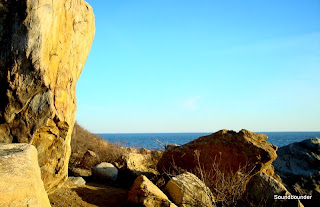
With the late season sun low in the sky, some sections of the beach were shaded by the trees atop the bluffs to my south (It gets late early there). Along those stretches, I walked below the high tide mark, and weaved my way between the large rocks that were wet from the waist down. What I like most about Wildwood is the beach has been left in its natural state. In order to accommodate large crowds, state parks often groom the beaches, making them more user friendly, but less authentic. Wildwood has left in place the large glacial erratics and boulders strewn along the mile-and-a-half beach. And for now at least, it's views are undisturbed.
*

Friday, 7 August 2009

Silver Sands State Park


This was a pleasant surprise. I had never visited Silver Sands State Park in Milford until this summer. The 47 acre park consists of salt marsh, beach, and open fields. In the distance sits Charles Island, a nature preserve which can be reached during low tide.
This is the newest of state parks in Connecticut. Approximately 75 homes stood here before Hurricane Diane destroyed them in 1955. Acquired by the state, portions of the property then served as a landfill during the 1960's and 70's. I am not sure how long the park has been in existence, but I believe it has been only for a decade or so.
Like many state parks, it gets crowded, especially on weekends. But I noticed the crowds thin significantly on the far western end of the beach. Best of all, it is free. There are no admission fees, parking charges, or residency requirements.
I would like to come back here in the autumn months and perhaps explore Charles Island. The 14 acre island can be reached by a tombolo (new word) that extends from the beach.


CT Coastal Access Guide: Silver Sands State Beach

Saturday, 6 June 2009

Monday, 18 May 2009

Lloyd Point


"the long, bare, unfrequented shore that I had all to myself"
Walt Whitman

When I was first tossing around ideas about a blog devoted to Long Island Sound, I thought about a grading system for the parks and beaches. Eventually I decided against this idea because there were too many variables and intangibles. A beach that might be perfect for a winter walk was a poor place to spend a summer afternoon. An ideal place to read a book would be an inappropriate place to bring the kids. A beautiful municipal park might be a poor choice for a nature lover. I decided to treat each location for what it is.
Had I decided on a rating system, Caumsett State Park would have scored an A; maybe even an A+. In my opinion, this is one of the premier pieces of public coastal access land on Long Island Sound. Acquired by the state in 1961, the former Marshall Field III estate is 1600 acres of farmland, salt marsh, horse stables, and footpaths.
One drawback here is that a significant amount of walking is required to reach the water. In many ways however, this can be seen as a positive. The two mile walk along the bridle path is an easy one and it tends to discourage the beach cooler crowd from overrunning the park.
My visit in early April focused on Lloyd Point which is a sandy peninsula in the northwest corner of the park. A few hikers and early season fishermen dotted the shoreline, but for the most part it was as if I had the beach all to myself.

New York Parks: Caumsett State Park
The Caumsett Foundation
Map

Friday, 24 April 2009

That First Day


We have had a fair share of Spring-like days in the past several weeks, but last Saturday broke new ground. With the thermometer reaching into the 70's, it seemed as if everyone was outdoors. People were working in their gardens, children were flying kites, and shorts with a T-shirt didn't seem very out of place. West Beach at Hammonasset State Park was busy as well.
I stopped by late in the afternoon, but there was still plenty of activity. The beach blankets were spread out and the sound of chatter filled the air that had been silent for the previous months. A few brave souls ran into the water, and a windsurfer made his way along the shoreline. There was a cool breeze off the water, but for the first time in many months, I could feel the heat of the sun on my back.
The forecast for this week looks equally pleasant. Spring (not that fake 52 degree Spring) is really here.

Hammonasset State Park
SOUNDBOUNDER: Meigs Point
CT Visit: Spring Bird Walks At Hammonasset
Map

Monday, 13 April 2009

Cold Spring Harbor State Park


Along Route 25A on the Nassau-Suffolk County line sits Cold Spring Harbor State Park. This is a forty acre park that climbs the bluffs that surround this attractive harbor. The park also serves as the northern trailhead to the Greenbelt Trail that links Long Island Sound to the Atlantic Ocean.
I have been delaying my visit here for several months. The entrance to the trails involves a steep climb that would be difficult with an icy or muddy ground. I also did not want to visit when the leaves were in full bloom, thus limiting the view of the harbor below. My timing paid off handsomely. The air was about 50 degrees, but the sun was strong, and I was protected from the wind by the hills to the south.
It is easy to see why this area was so appealing to the industrialists who built their grand estates here a century ago. The deep harbors, wooded bluffs, and irregular coastline make for an attractive setting. I didn't get much hiking in. I climbed the hill and found an overlook that provided an excellent view of the harbor below.
I sat myself down on a rock and took it all in.

New York State Parks
Map
Loving Long Island: Cold Spring Harbor
Explore Long Island: Cold Spring Harbor State Park
Hike Long Island
Huntington Audubon Society

Saturday, 7 February 2009

Salt Marsh At Sunken Meadow


Maybe everyone was watching football. The massive, 1200 acre Al Smith/Sunken Meadow State Park was practically empty when I visited on a Sunday morning in January. I too, had plans to watch the playoff games, but kickoff was not until around 4PM, and a return visit seemed like a good idea. Previously, I had walked along the boardwalk that lines the beach here, and learned of a salt marsh that is on the eastern end of the park.
At the base of the glacial moraine that rises to the south, is the Sunken Meadow Creek that works its way east, and meets the Nissequoque River, before flowing into Smithtown Bay. The tidal flats and marshes that are north of the creek, form the sunken meadow that provides the park with its name. This is a transitional zone between the freshwater landscape of the inland areas, and the saltwater tides of the Sound.
It is a rare day, to not come across another soul at a state park, in the western portion of Long Island. Sunken Meadow is designed to accommodate large masses of visitors. But this particular Sunday allowed me to fully appreciate Walt Whitman's words about "the long, bare, unfrequented shore that I had all to myself." A few birds hiding in the cordgrass, and a rabbit that went scooting by, were the only other visitors I saw.
Salt marshes were once harvested for their hay, but in the early 20th century, they were viewed as undesirable land. Before we understood the role these marshes play in the ecological health of our waters, we had filled in a good portion of them. Many of the state parks and beaches are no exception; Sherwood Island, Orchard Beach, and Sunken Meadow were all created by filling in large marshes along the shoreline.
Fortunately at Sunken Meadow, this remaining marshland did not become another parking lot, playground, or golf course.

Sunday, 18 January 2009

The Boardwalk At Sunken Meadow


After a week or so of temperatures in the teens, yesterday's thermometer reaching 30 degrees seemed like a warm spell. I took advantage of the "heat wave" by visiting Al Smith/Sunken Meadow State Park in Smithtown. This is a LARGE park, both in acreage and waterfront.
It originally opened as a 520 acre park in 1930, and has expanded to over 1,200 acres through the acquisition of adjacent properties. In 1992, the name of the park was changed to honor former Governor Alfred E. Smith, who played a vital role in the creation of many New York metropolitan area parks.
I focused my visit on the three-mile beach area which includes a boardwalk that lines a portion of the beach. Despite the morning snowfall, there were a considerable number of people walking the 3/4-mile deck that was free of snow and ice. Smithtown Bay was silent, with barely a ripple on the surface. The sky had a low, gray layer that thwarted any long distance visibility. The only landmark I could see was a foggy and blurry Crane Neck, several miles to the northeast. A few gulls used their beaks as icepicks, digging through the snow and ice to reach the shells and sand below. Several Canadian Geese got some much needed rest and relaxation, after a busy week of sabotaging departing jets at LaGuardia Airport.
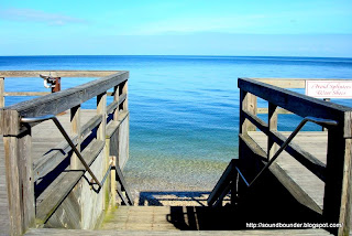
Like many state parks, there is a certain generic quality to the architecture here. Most of the buildings and structures are nearly identical to those found at other state parks in the Adirondacks and Hudson Valley. Even the railings along the boardwalk looked familiar. This however, is really a small complaint that rests more in a quirky pet-peeve of mine, than in any legitimate criticism. The state park system is so extensive that creating and maintaining unique, locally influenced structures would not be cost effective. In the end, it is the park itself that matters, not the refreshment stands.
I reached the end of the boardwalk, and continued walking westward along the beach. At this point, there were no footprints in the snow, and everything seemed silent. The glacier-formed bluffs rose in the distance, blocking from sight the four stacks of the Keyspan Power Station in Northport. I have seen those stacks from as far away as New Haven, CT, and Westchester County, NY. I found it amazing to be so close to them, yet unable to see them. Sometimes, "not seeing the forest for the trees" is an admirable quality.
I reached an area of the beach that was quite icy and dangerous, so I turned around, and made my way back. I came upon a friendly couple who were taking a break from their cross-country skiing. They were quite familiar with the park, and were able to describe some trails, and a marshland area that I was not aware of. This is the type of park where one can visit many times, and still find new places to explore. There is too much here to discover on one Sunday afternoon in January.

AL SMITH/SUNKEN MEADOW STATE PARK: WebAlbum
Map